
Tenement Revaluation- Targeting orogenic gold mineralization by analysing Worldview-3 imagery integrated with other exploration datasets (Camp Scale)
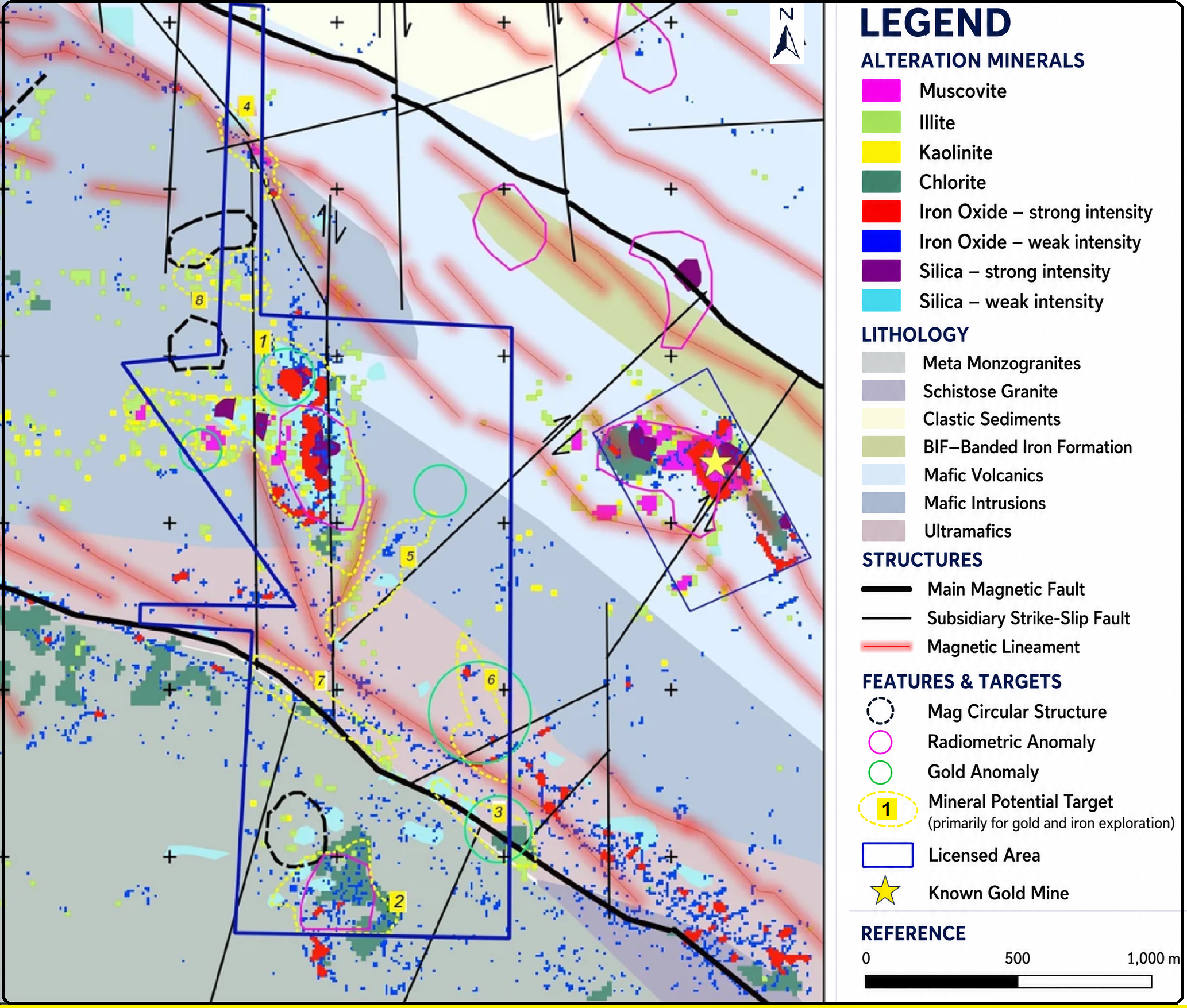
This project utilised commercial high-resolution multispectral WorldView-3 imagery integrated with additional exploration datasets such marantic, geochemical and geological data and mineral systems analysis to identify favourable orogenic gold mineralization targets with and at the proximity of a 7 km2 tenement. VNIR and SWIR data were processed in SuperCube format, ensuring precise co-registration, atmospheric correction, and consistent spectral analysis at high resolution. The workflow enabled detailed mapping of alteration minerals (phyllic, argillic, propylitic, carbonates, and silica), iron oxides, and structural features by using similar indicator features from the nearby orogenic gold deposits, delivering reliable targets to support focused and cost-effective on-ground gold exploration.
Mineral System of the area: Orogenic Gold
Deliverables:
Source and super spectra SWIR, VNIR, Pan data
High-resolution base maps, including 30 cm resolution Pan image
Favorable color composite Images
Alteration and iron oxide mineral Occurrence/Intensity Maps
Favorable mineral vectors (shapefiles)
Reclassified regional geologic maps
Processed magnetic map of the area
Processed radiometric map of the area
Geochemical anomaly map of the area
Supervised classification maps
Faults and Lineament Map (shapefiles)
Integrated Targets Map showing first and second priority targets (GeoTiff map and shapefile)
Report (PowerPoint Presentation)