
Advanced Geoscientific Data Analysis
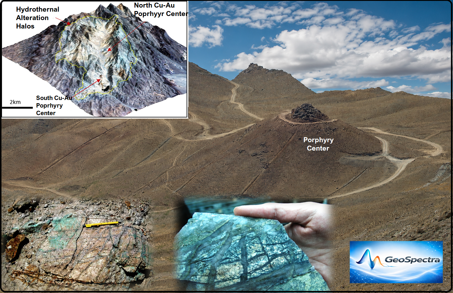
GeoSpectra analyse and integrate geological, geophysical, geochemical and field data, to map the subtle, complex footprints of the concealed mineralization systems. Our advanced data processing filters out background geological noise, allowing exploration teams to identify deep-seated structural traps, blind intrusions, and geochemical halos associated with ore deposit.
Subsurface Magnetic Targeting
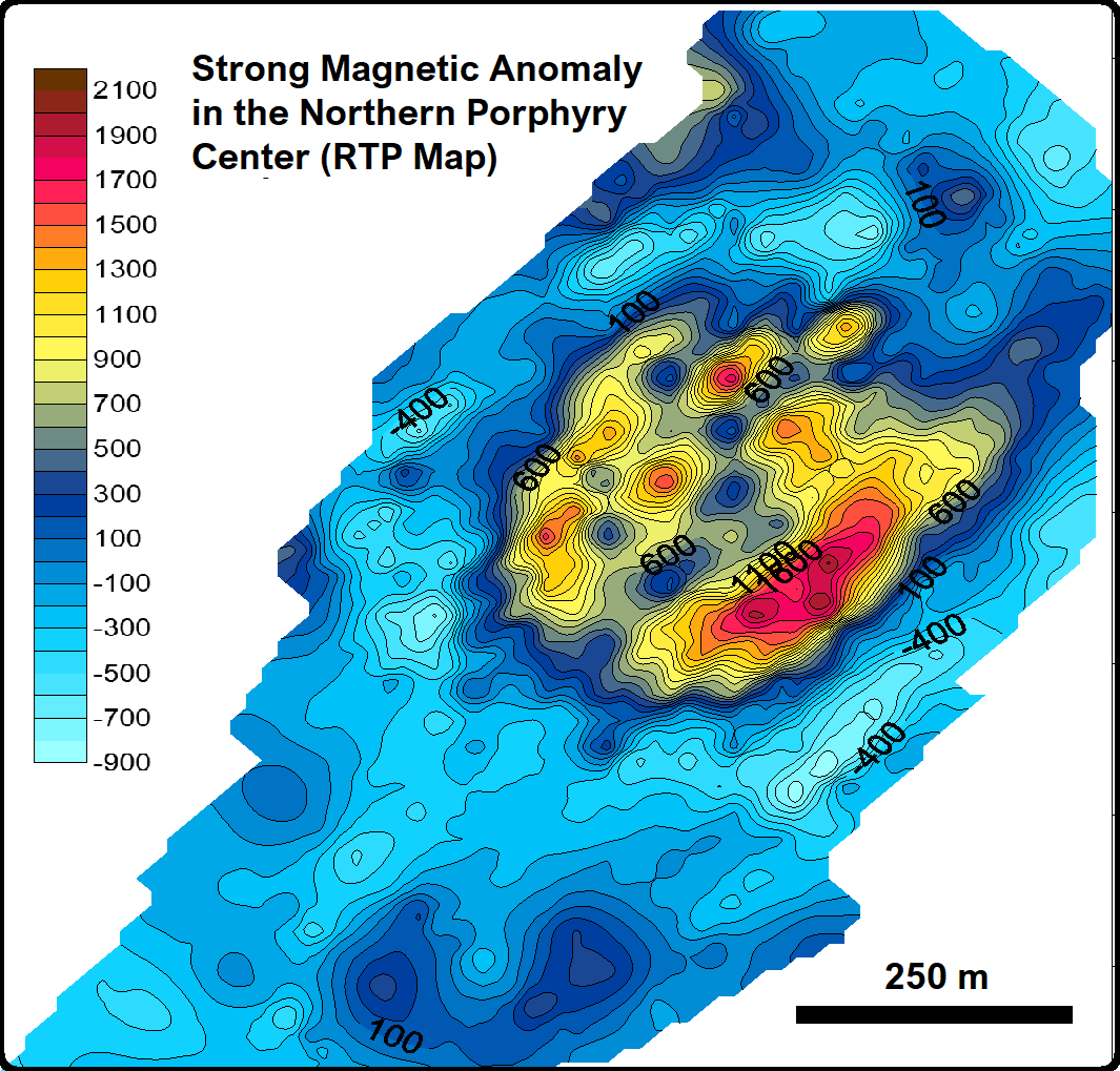
GeoSpectra utilizes high-resolution ground magnetic data to identify hidden porphyry centers. Our processing detects intense magnetic highs that directly pinpoint hydrothermal magnetite enrichment within the potassic core, associated with high-grade copper-gold sulfide concentrations, providing the critical geometric and depth data needed to optimize drill-hole placement and reduce exploration risk.
Geochemical Soil Targeting
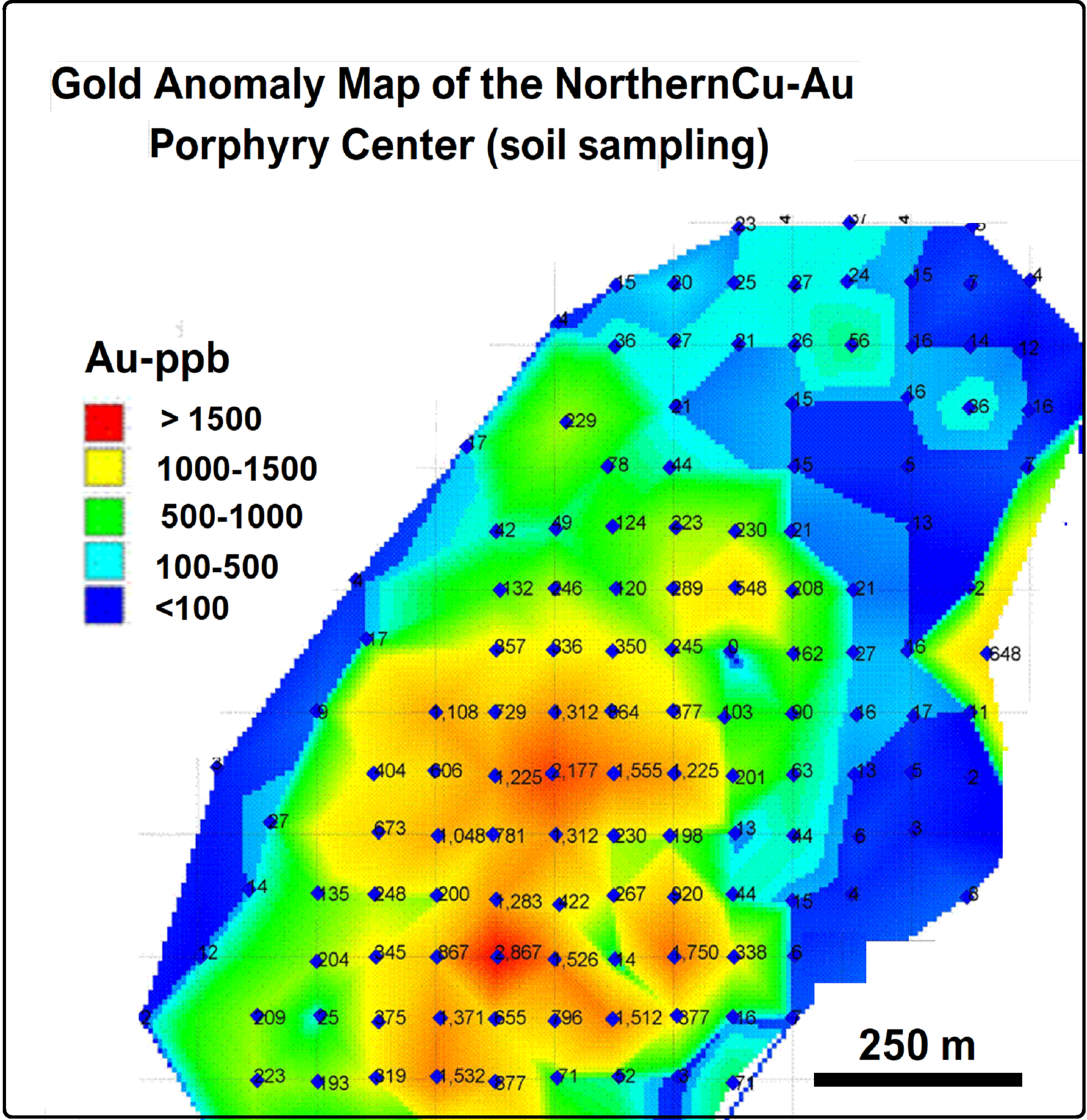
Systematic geochemical sampling serves as a direct chemical window into mapping of the dispersed footprints of both surface and concealed mineral systems. By collecting gridded soil/rock samples, GeoSpectra tracks anomalous element concentrations such as the high-grade gold signatures exceeding 1000 ppb displayed here. Processing and contouring these datasets allows us to accurately delineate core mineralization zones, providing a reliable surface vector to define high-priority drilling targets.