

Critical Mineral Targeting
GeoSpectra applies advanced spectral remote sensing to identify indicator minerals in critical mineral systems, including lithium-bearing minerals (e.g., lepidolite, spodumene) and iron oxides in pegmatites, calcite–silica–iron oxide-clay signatures in REE-bearing carbonatites, and dolomite–clay–silica- iron oxide signatures in Gallium–Germanium-bearing MVT systems.
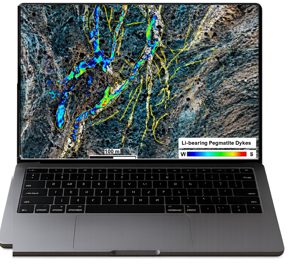
Targeting Critical Minerals
GeoSpectra specialises in cutting-edge spectral analysis of high-resolution satellite imagery to optimize on-ground targeting of critical minerals (e.g., lithium-bearing minerals in pegmatites, gallium-germanium-bearing indicator minerals in MVT, and REE alteration indicators in carbonatite systems).
Scalable Solutions: From reconnaissance to camp-scale targeting.
Critical Metals: Lithium (Li), Gallium (Ga), Germanium (Ga), REE (La, Cs, Nd, Eu, Ce, Sm, Tb, Y, Dy, Pr)
High-Resolution Remote Sensing by Analysing WorldView-3 Imagery for Critical Elements Exploration
Mapping Subtle Spectral Signatures and Structural Features in Camp-Scale targeting of Critical Elements (Gallium and Germanium) associated with MVT mineral systems
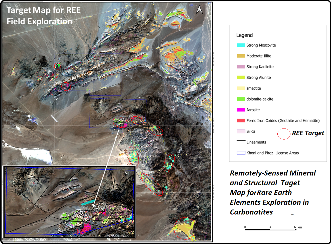
Analysis of Hyperspectral EnMap Imagery for targeting regional-scale REE Targets for field follow-up exploration in carbonatites.
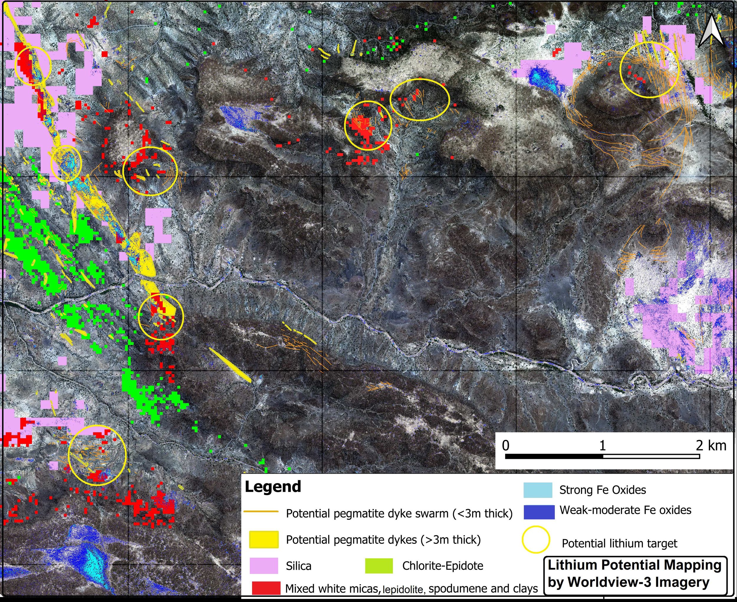
Camp-Scale Mineral Mapping
GeoSpectra delivers advanced analysis of high-resolution Worldview-3 imagery to map pegmatite dykes (1-20 m thick), iron oxides and key indicator minerals such as Li-bearing lepidolite and spodumene minerals