
Multispectral Mineral Mapping
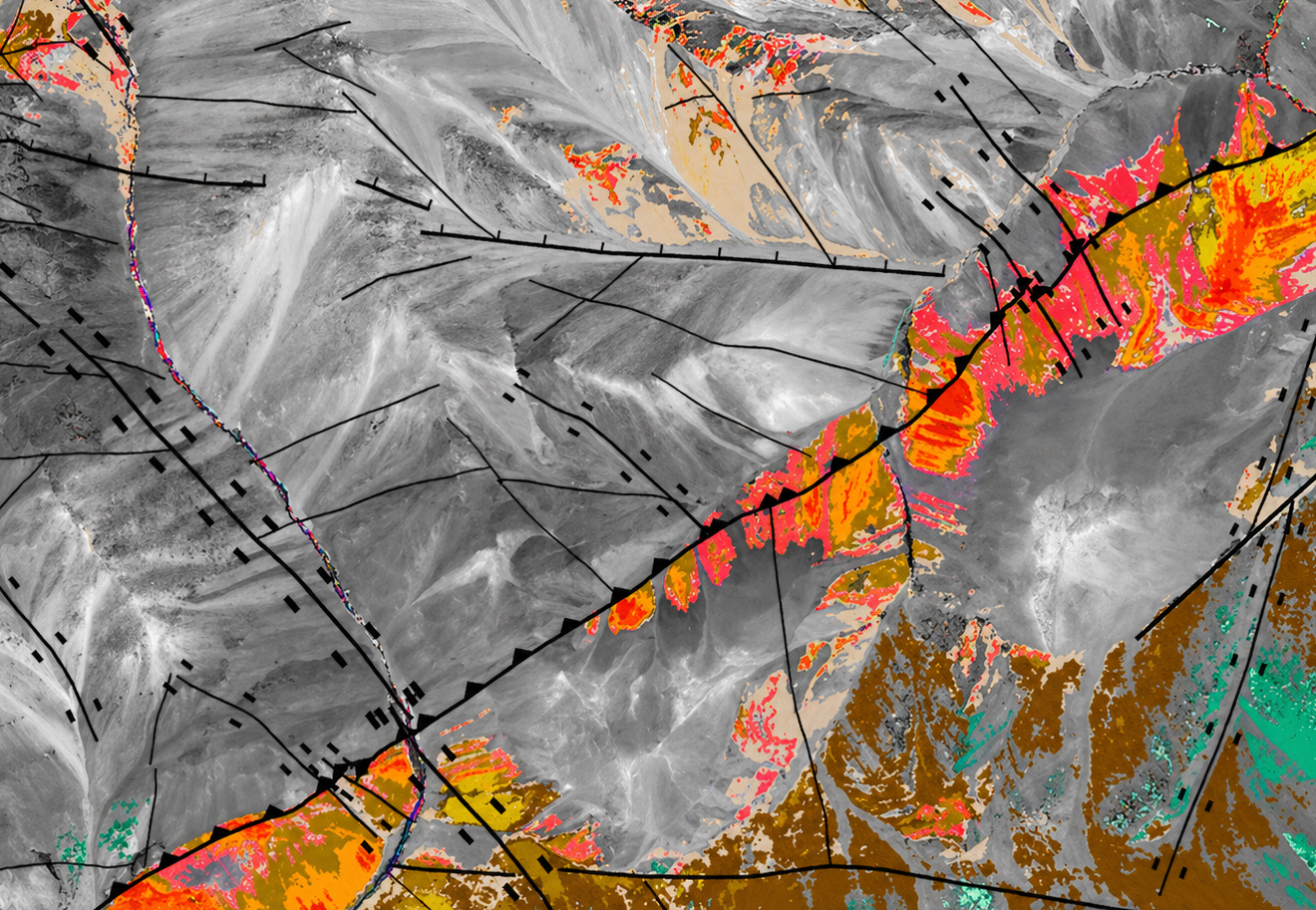
GeoSpectra delivers advanced spectral analysis of medium to high-resolution multispectral imagery (e.g., Aster and Worlview-3) to map structures and key alteration minerals of the area’s mineral systems, including favorable clays, sulphates, carbonates, iron oxides, and silica, for regional and camp-scale on-ground exploration.
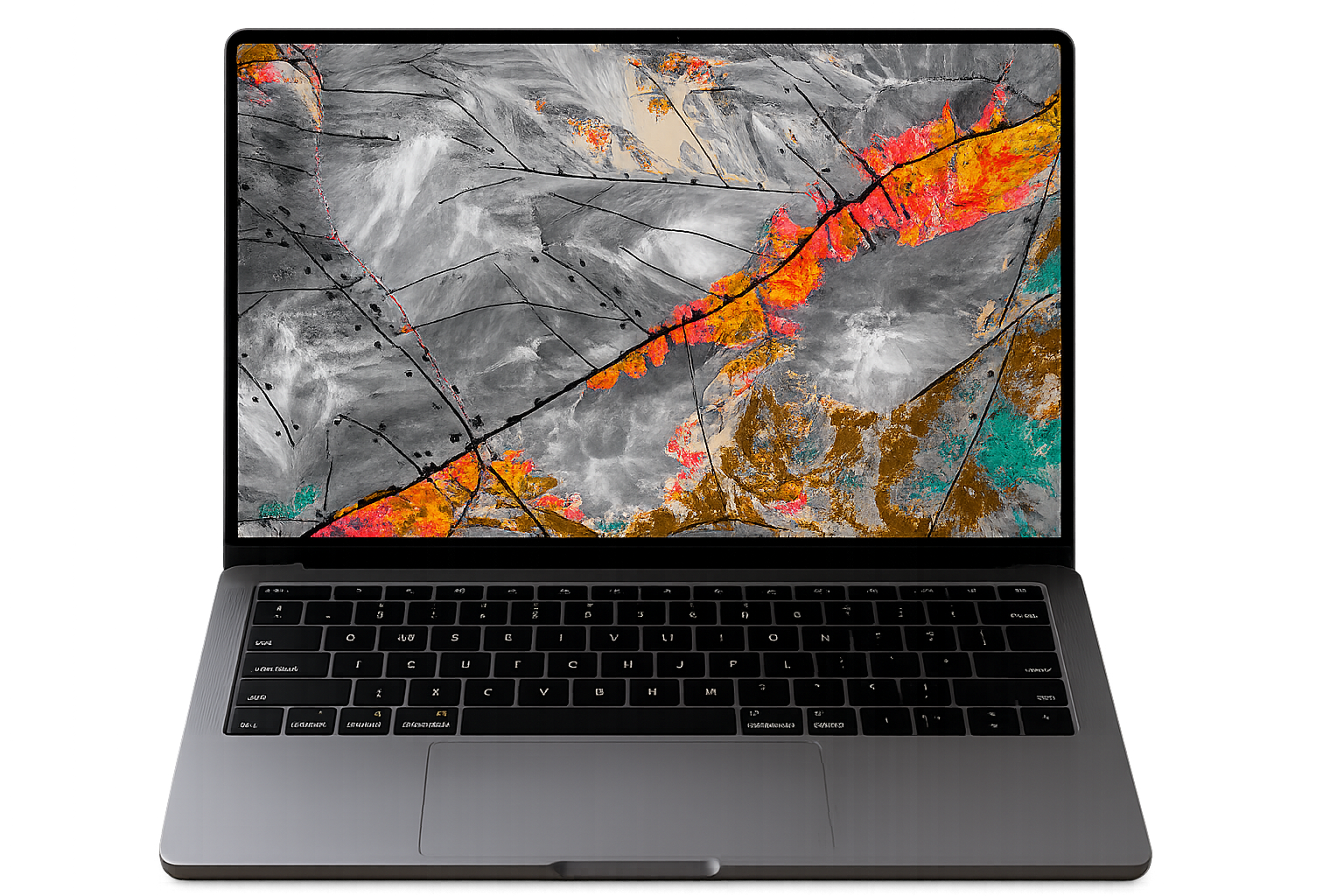
Advanced spectral insights for smarter mineral exploration
GeoSpectra delivers high-precision multispectral analysis using industry-leading satellite data such as ASTER and WorldView-3, enabling rapid identification of mineral systems, structural controls, and alteration zones across regional to camp-scale projects.
By leveraging spectral signatures across visible, near-infrared (VNIR), and shortwave infrared (SWIR) bands, our workflows detect and map key mineral groups including clays, sulphates, carbonates, iron oxides, and silica—critical indicators of mineralisation.
Camp-Scale Mineral/Structural Mapping and Target Generation by Spectral Analysis of Worldview-3 Imagery

WorldView-3 (WV3) satellite is one of the most advanced commercial Earth observation sensors with 17 spectral bands, including 8 VNIR bands (400–1040 nm, 1.2m spatial resolution), 8 SWIR bands (1195–2365 nm, 3.7 m resolution), and 1 panchromatic band with 0.31 m resolution. It is used for detailed prospect-scale mapping by high-resolution identification of favorable alteration minerals, lithologies, veins, and structural features associated with certain mineral systems.
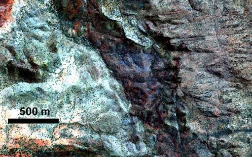
GeoSpectra delivers high-resolution colour composite image of multispectral WV-3 imagery (e.g. RGB532-true colour) to map detailed lithological boundaries and structural features in a Prospect Scale.
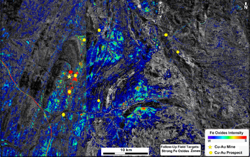
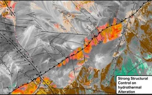
GeoSpectra applies advanced analsis of high-resolution multispectral WV-3 imagery to map favorable prospect-scale alteration mineral intensity map (e.g., clays, micas, iron oxide, opaline-silica, jarosite, and 2350 nm minerals including chlorite, epidote, dolomite, and calcites), helping delineate certain mineralization footprints.
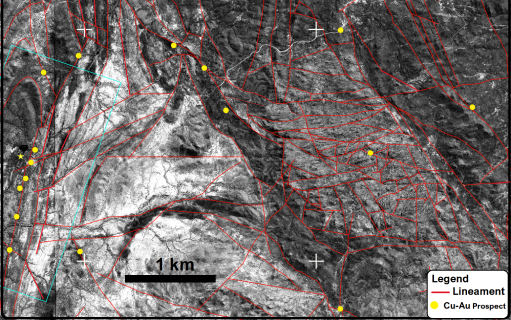
GeoSpectra delivers advanced structural analysis using high-resolution WV-3 satellite imagery to identify faults and lineaments that control the circulation of hydrothermal fluids and mineralisation. These structural datasets are integrated with other geospatial and exploration data to support mineral target generation.
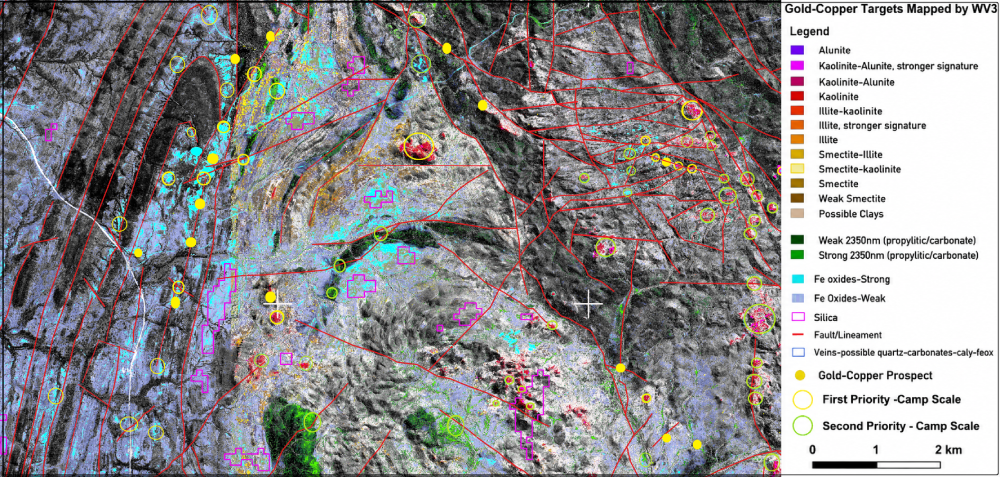
GeoSpectra applies advanced spectral analysis of high-resolution WV-3 imagery to map key indicator minerals associated with the area’s mineral systems, including alunite, pyrophyllite, phengite, favourable clays and micas, ferric and ferrous oxides, chlorite, epidote, carbonates and sulphates. These signatures are integrated with structures, favourable lithologies, and other exploration datasets to locate prospect-scale targets for on- ground exploration.
Key Outputs & Capabilities
Detailed mineral mapping, including mineral type, intensity, and alteration zonation
Advanced structural and lineament analysis
Lithological and alteration classification
Customised RGB imagery for multi-purpose geological applications
Mineral prospectivity analysis and target generation
GIS-ready datasets and deliverables for integration into exploration workflows
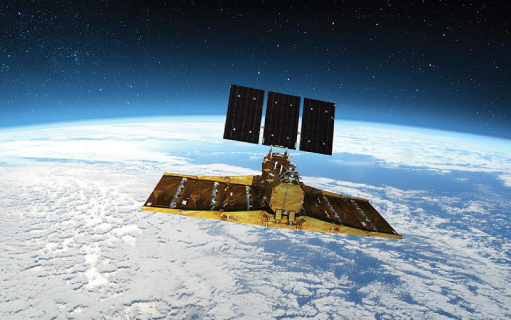
ASTER satellite imagery contains 14 spectral bands, including 3 VNIR bands (520–860 nm, 15 m spatial resolution), 6 SWIR bands (1600–2430 nm, 30 m resolution), and 5 TIR bands (8125–11650 nm, 90 m resolution). It is used for regional-scale mapping of hydrothermal alteration minerals (clays, micas, etc.), iron oxides, silica, chlorate/epidote, carbonates, clays, and lithological variations, and lineaments associated with various mineral systems.
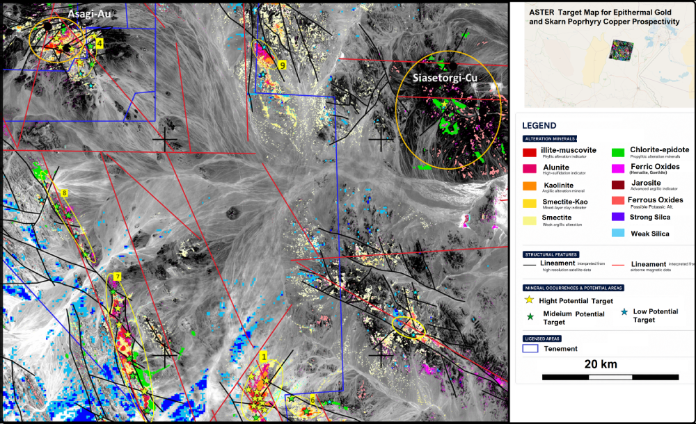
GeoSpectra applies advanced spectral analysis of medium-resolution ASTER imagery to map key indicator minerals associated with the region’s mineral systems, including favourable clays and micas, ferric and ferrous oxides, chlorite, epidote, carbonates, sulphates, and silica. These signatures are integrated with structures, favourable lithologies, and other exploration datasets to locate regional-scale targets for on- ground exploration.