
Geospatial Modeling
Geospatial modeling plays a crucial role in modern mineral exploration by transforming complex datasets into structured, interpretable models that guide decision-making. By integrating geological, geophysical, and geochemical data within spatial frameworks, it enables exploration teams to better understand subsurface conditions and identify high-potential zones with greater accuracy.
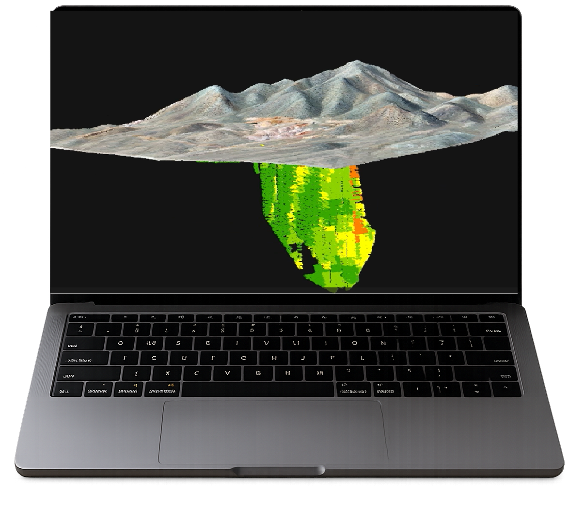
Geospatial Modeling
GeoSpectra combines a mineral systems framework with advanced machine learning to locate and optimize drilling targets and models the resources across the exploration lifecycle.
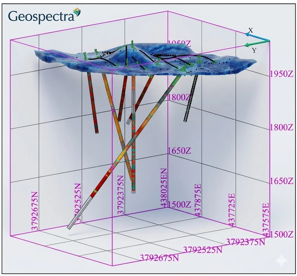
AI-Driven Drilling Targeting
GeoSpectra integrates 2D structural, geophysical, geochemical, and geological datasets to identify and rank scout-drilling targets. As data is acquired, our semi-supervised machine learning algorithms merge the surface signatures with 3D borehole assays and lithological logs. By analyzing both results simultaneously, our workflow models ore-body continuity—enabling exploration teams to precisely target infill drilling and accelerate reliable reserve estimation.
Why Choose Us

Advanced Machine Learning Integration
We leverage cutting-edge AI and semi-supervised models to enhance accuracy and reduce interpretation bias.

End-to-End Exploration Support
From early targeting to resource estimation, our models support every stage of the exploration lifecycle.

Scalable & Adaptive Models
From regional studies to detailed project analysis, our approach adapts to your exploration needs while saving time and costs.
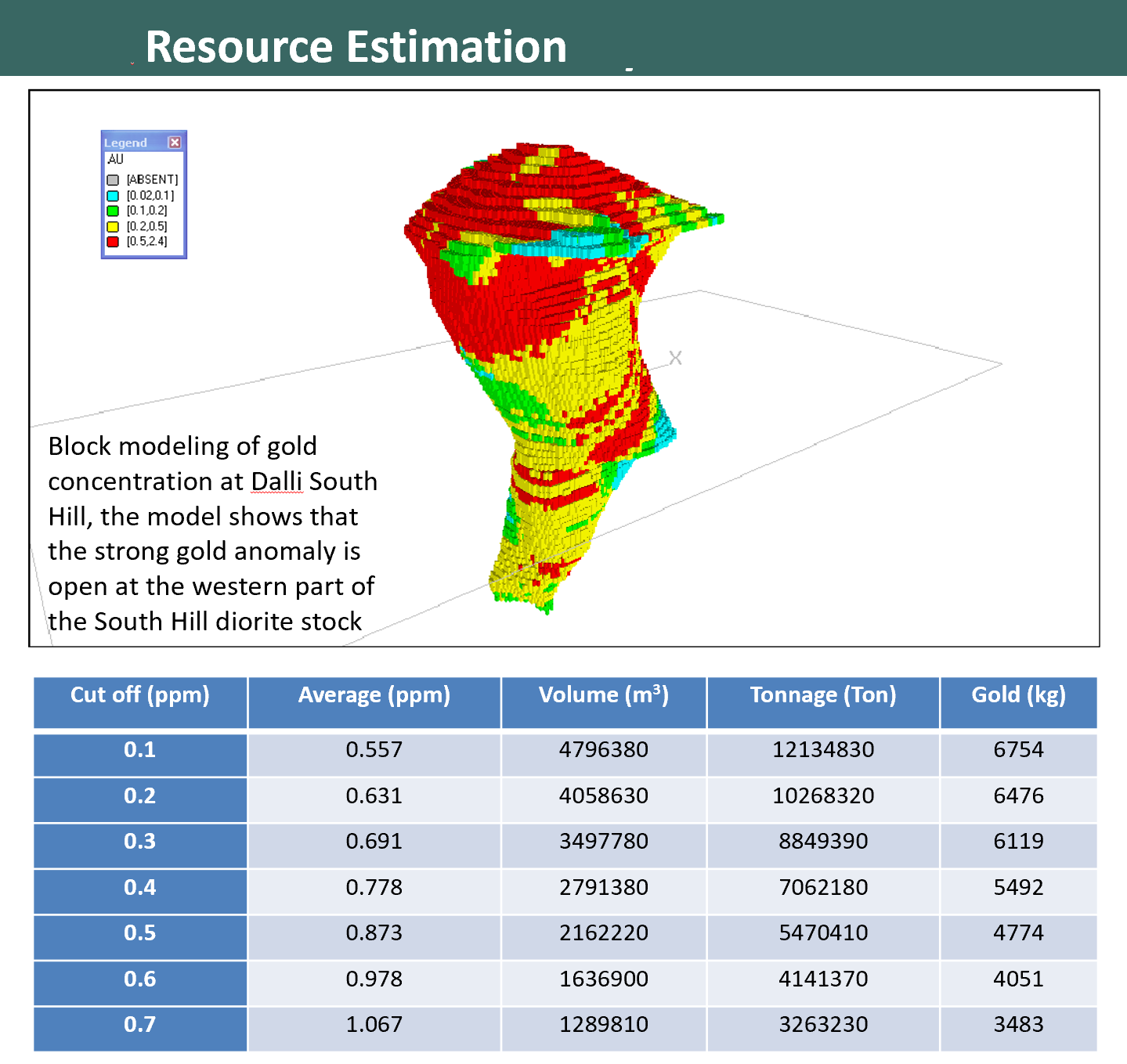
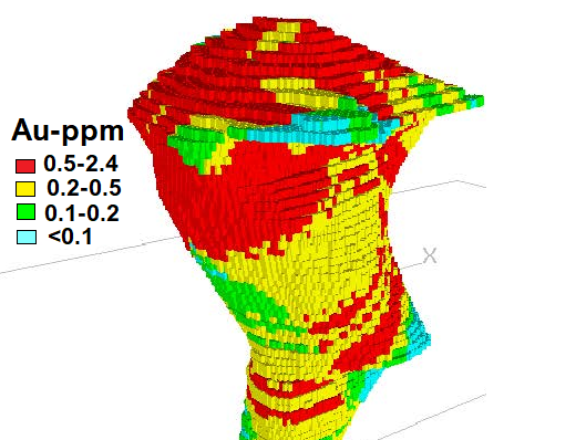
Resource Estimation
Following precise drilling programs, GeoSpectra conducts resource modelling and reserve estimation, delivering robust, data-driven models to support strategic decision-making. This integrated approach enhances targeting precision, reduces exploration risk, and improves discovery efficiency by maximising both resource tonnage and ore grade.
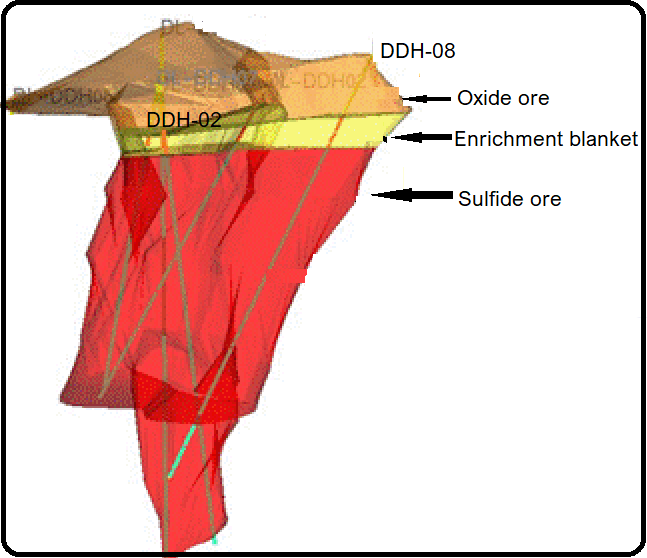
Deposit Modeling
GeoSpectra models various sections of the deposit for decision making. In this picture, the porphyry deposit is divided into three distinct vertical zones: the upper Oxide Ore, where near-surface weathering and oxygen interaction altered primary minerals; the intermediate Enrichment Blanket, a high-grade layer formed where leached metals have precipitated; and the deep Sulfide Ore, which comprises the original, unaltered hypogene core.