
AI Data integration and Target Generation
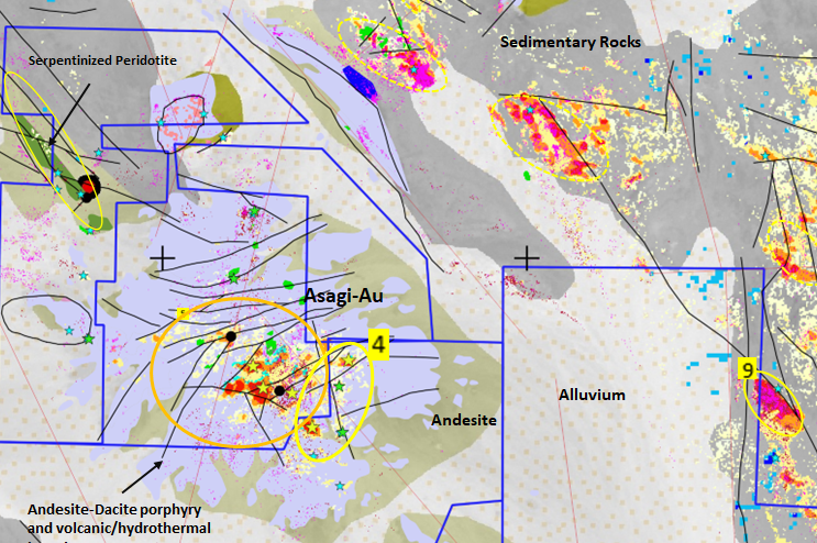
GeoSpectra delivers integrated regional prospectivity workflow, based on the area’s mineral systems, by identifying favorable exploration features (e.g., geological and structural maps, remotely-mapped alteration minerals, catchment basin geochemical stream sediment signatures, and magnetic anomalies)and combining them within a hybrid AI framework (e.g., neuro-fuzzy) for mineral target generation.
Geological Foundations (Lithology & Structure)
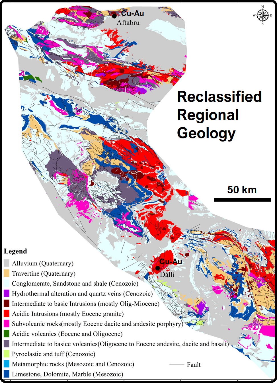
A robust AI prospectivity model begins with understanding the plumbing system and host rocks of a mineral system. GeoSpectra integrates regional lithological maps to isolate critical rock types, such as intrusive or volcanic complexes, that act as the source or hosts for mineralizing fluids. Simultaneously, we map lineament density to identify faults and structural fractures. These structural networks serve as the primary pathways for hydrothermal fluids, allowing us to pinpoint high-permeability zones where economic mineralization is most likely to trap.
Geochemical Exploration Anomalies
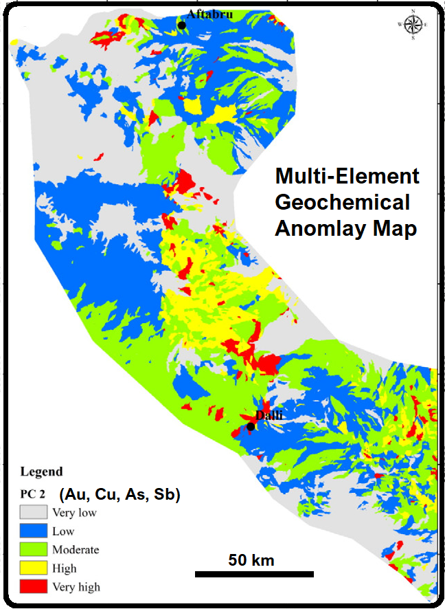
GeoSpectra incorporates surface chemistry into the predictive model. By analysing catchment basin multi-element geochemical data, we track the actual chemical footprint of copper and gold left behind in stream sediments. Our framework processes these complex, multi-variable geochemical data streams to filter out background noise, highlighting distinct anomalous zones that indicate active, eroding mineralization upstream.
Why Choose Us

Intelligent Data Integration
We combine multiple datasets into a single, AI-powered framework for deeper and more accurate insights.

Predictive Targeting Capabilities
Our machine learning models identify high-potential zones, helping you focus on the most promising targets.

Scalable & Efficient Solutions
From regional studies to detailed project analysis, our approach adapts to your exploration needs while saving time and costs.
AI Data Integration & Mineral Target Generation
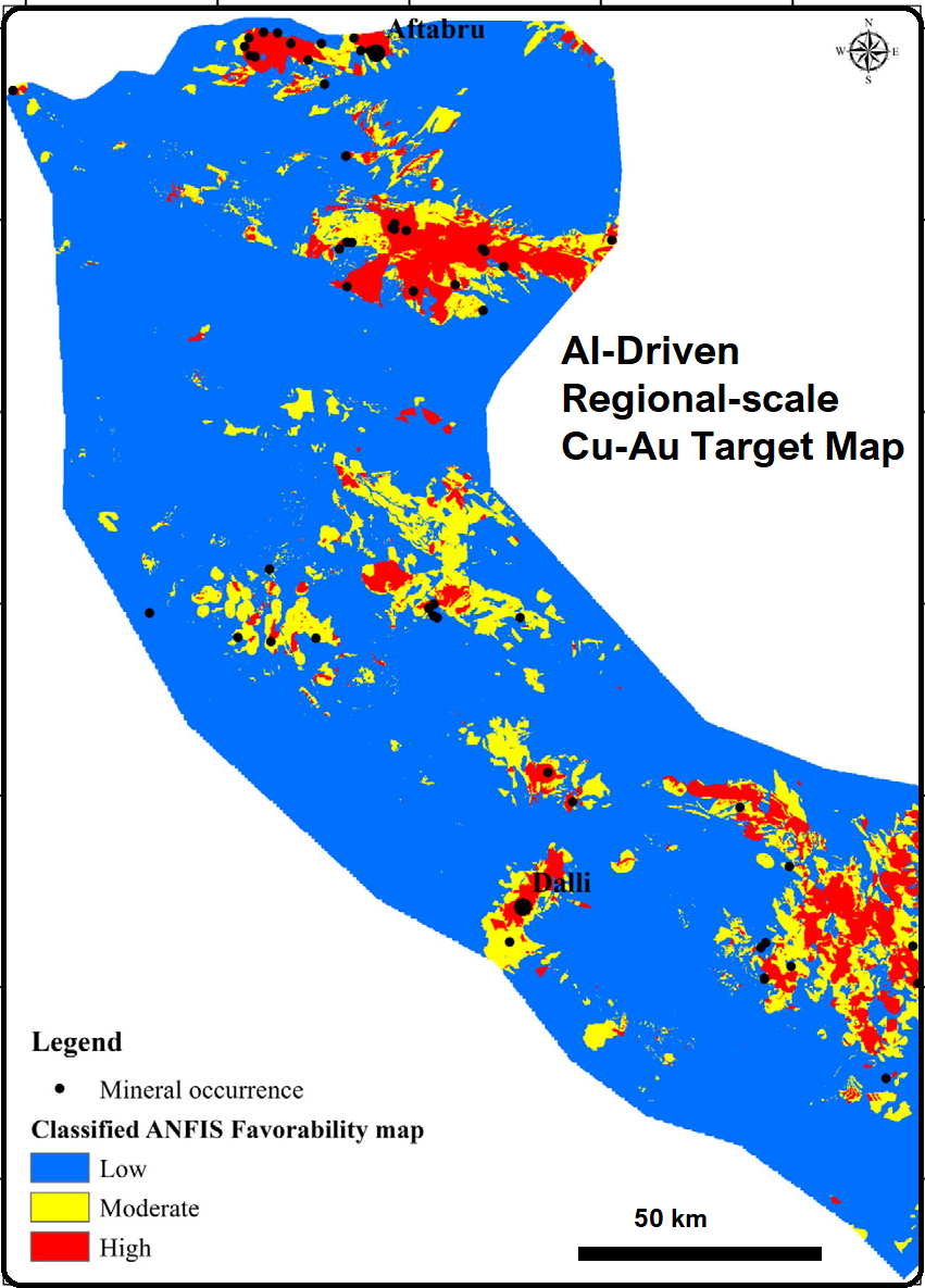
The core of GeoSpectra’s capability lies in integrating several datasets. By utilizing a sophisticated hybrid AI neuro-fuzzy framework (ANFIS), we mathematically overlay the geological, structural, geochemical, geophysical, and alteration layers. As demonstrated in the final Regional Target Map, the AI model cross-references these data vectors with known mineral occurrences as training sites to generate highly accurate favourability zones. The final output classifies the terrain into low, moderate, and high-priority targets, enabling exploration companies to drastically reduce risk and confidently allocate drilling budgets.
Regional Prospectivity Modelling
GeoSpectra also delivers integrated regional prospectivity modelling by using mineral systems and combining multi-source favorable exploration datasets through conventional data overlay and empirical integration frameworks for mineral target generation.