
Targeting REE mineralization by analysis of hyperspectral EnMap Imagery (district scale)
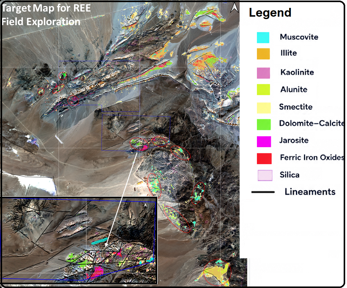
This project utilizes spaceborne hyperspectral EnMAP - featuring a 30 m spatial resolution with 242 narrow spectral bands spanning the VNIR and SWIR ranges—integrated with multispectral ASTER data. By combining EnMAP’s high spectral resolution with ASTER’s proven multispectral capabilities (particularly in the SWIR and TIR regions), this integrated systems analysis identifies highly precise mineral targets for district-scale critical element (REE) on-ground exploration.
Deliverables (GIS-ready):
Mineral System information of the area of interest (AOI)
Raw image data
Full set of colour composites
Clay Prediction, Silica Prediction, and Fe oxides (ferric, ferrous and jarosite) prediction Maps (Geo tiff)
2350 micro meters absorption (chlorite, epidote, carbonates) prediction Map
Favorable composite alteration images.
Vectorized alteration maps, with a separate layer for each mineral assemblage (shape files)
Lineament map
Final integrated ranked target map of the remote sensing results
Report (PowerPoint Presentation)