
Targeting gold mineralization by analysis of hyperspectral EnMap Imagery (district-scale mineral and structural mapping)
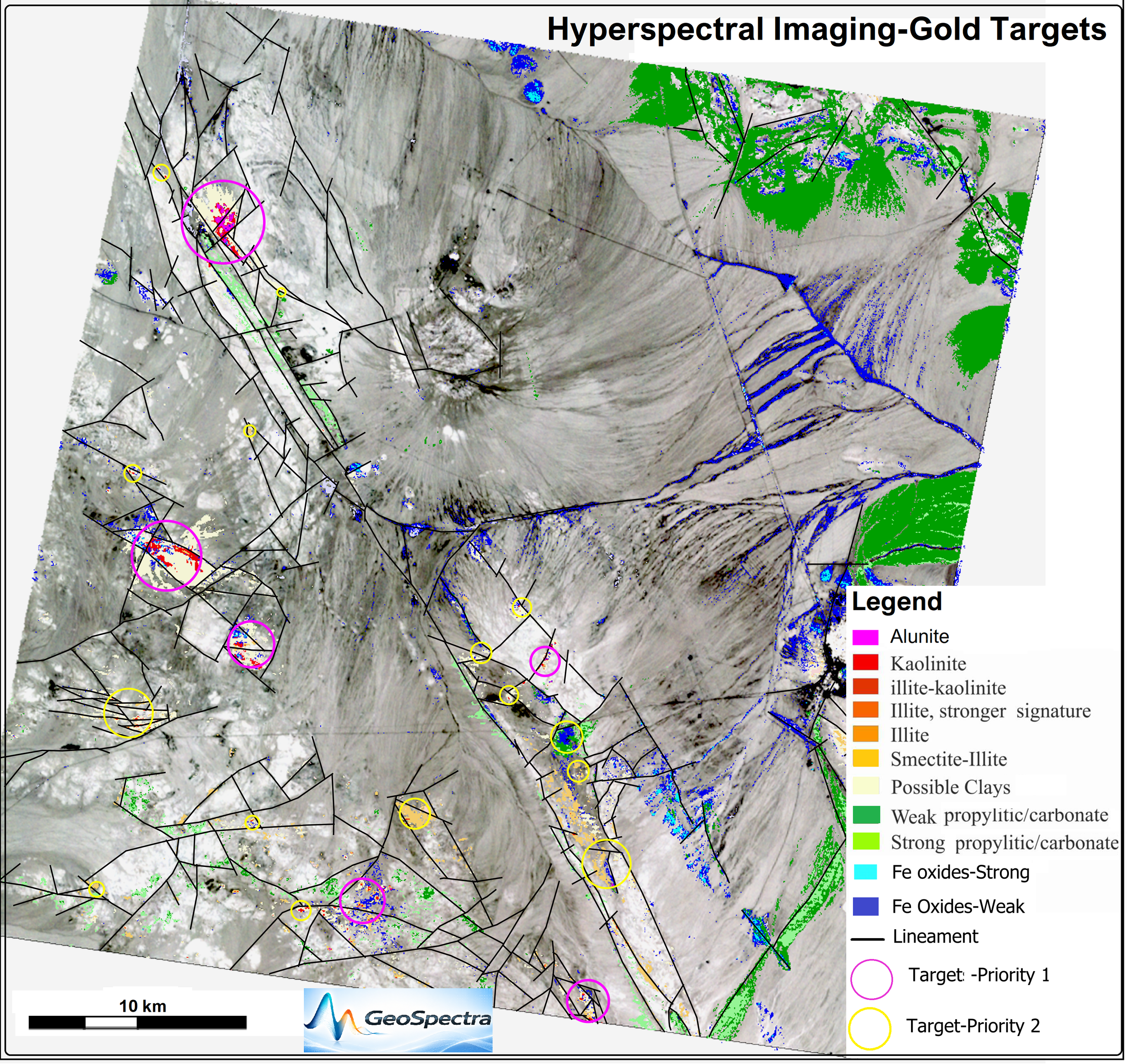
This project utilised spaceborne hyperspectral EnMAP (Environmental Mapping and Analysis Program) imagery, featuring a 30 m spatial resolution with 242 narrow spectral bands spanning the VNIR and SWIR ranges. This continuous spectral data was integrated systems analysis to identify highly precise mineral targets for gold exploration on a district scale.
Because hyperspectral data captures continuous diagnostic absorption features rather than broad spectral bands, VNIR and SWIR data cubes were processed using advanced workflows ensuring precise co-registration, atmospheric correction, and pixel-level spectral unmixing. This workflow enabled the detailed fingerprinting and mapping of specific alteration mineral chemistries (such as white sulphate such as alunite, mica crystallinity, specific clay species, and iron oxide phases) alongside structural features, delivering highly reliable targets to support focused and cost-effective on-ground copper-gold exploration.
Mineral System of the area: Epithermal Gold Mineralization
Deliverables (GIS-ready):
Mineral System information of the area of interest (AOI)
Raw image data
Full set of colour composites
Clay Prediction and Fe oxides (ferric, ferrous and jarosite) prediction Maps (Geo tiff)
2350 micro meters absorption (chlorite, epidote, carbonates) prediction Map
Favorable composite alteration images.
Vectorized alteration maps, with a separate layer for each mineral assemblage (shape files)
Lineament map
Final integrated ranked target map of the remote sensing results
Report (PowerPoint Presentation)