
Targeting copper- gold mineralization by analysis of ASTER and Sentinel 2A Imagery (regional-scale mineral and structural mapping)
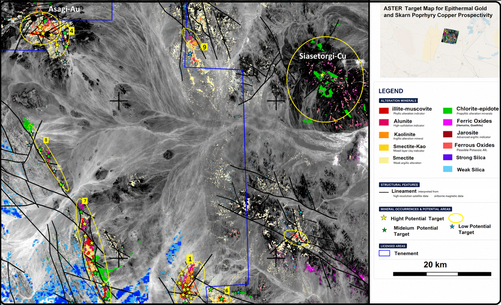
Mineral spectral analysis isn’t merely algorithmic processing—it is an art informed by experience. through customized mineral-system workflows, rigorous data calibration, favorable data-driven feature extraction, and expert manual refinement. This project utilised medium-resolution multispectral Aster (30 m resolution) and Sentinel 2A (10 m resolution) imagery integrated with reclassified regional geology and magnetic faults and mineral systems analysis to identify favourable mineral targets for copper and gold exploration in a regional scale. VNIR and SWIR data were processed in ensuring precise co-registration, atmospheric correction, and consistent spectral analysis. The workflow enabled detailed mapping of alteration minerals, iron oxides, and structural features, delivering reliable targets to support focused and cost-effective on-ground copper-gold exploration.
Mineral System of the area: Epithermal, Skarn Porphyry and ophiolite host minerals (Cr, Mg, Cu, Au, etc.)
Deliverables (GIS-ready):
Mineral System information of the area of interest (AOI)
Reclassified regional geological map
Raw image data
Full set of color composites
Clay Prediction, Fe oxides (ferric, ferrous and jarosite) prediction, and Silica prediction Maps (Geo tiff)
2350 micro meters absorption (chlorite, epidote, carbonates) prediction Map
Favorable composite alteration images.
Vectorized alteration maps, with a separate layer for each mineral assemblage (shape files)
Lineament map
Final integrated ranked target map of the remote sensing results with other exploration data (if provided)
Report (PowerPoint Presentation)