
Spectra Analysis
Spectral Analysis
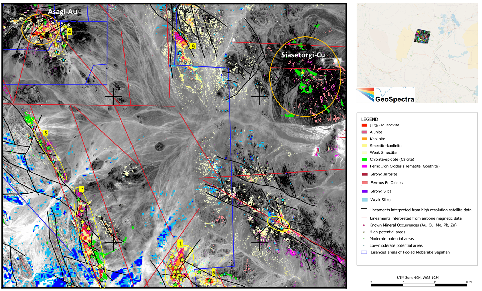
GeoSpectra delivers advanced spectral remote sensing for regional- to camp-scale mineral and structural mapping, supporting on-ground target generation and exploration for precious, base, and critical metals using multispectral and hyperspectral satellite imagery.Regional Target Generation
We process multispectral ASTER and Sentinel-2A, and hyperspectral EnMAP and PRISMA imagery to map key alteration minerals (argillic, advanced argillic, and propylitic), silica, carbonates, iron oxides, sulphates, and regional structures of certain areas’ mineral systems for on-ground mineral target generation at regional to district scales.
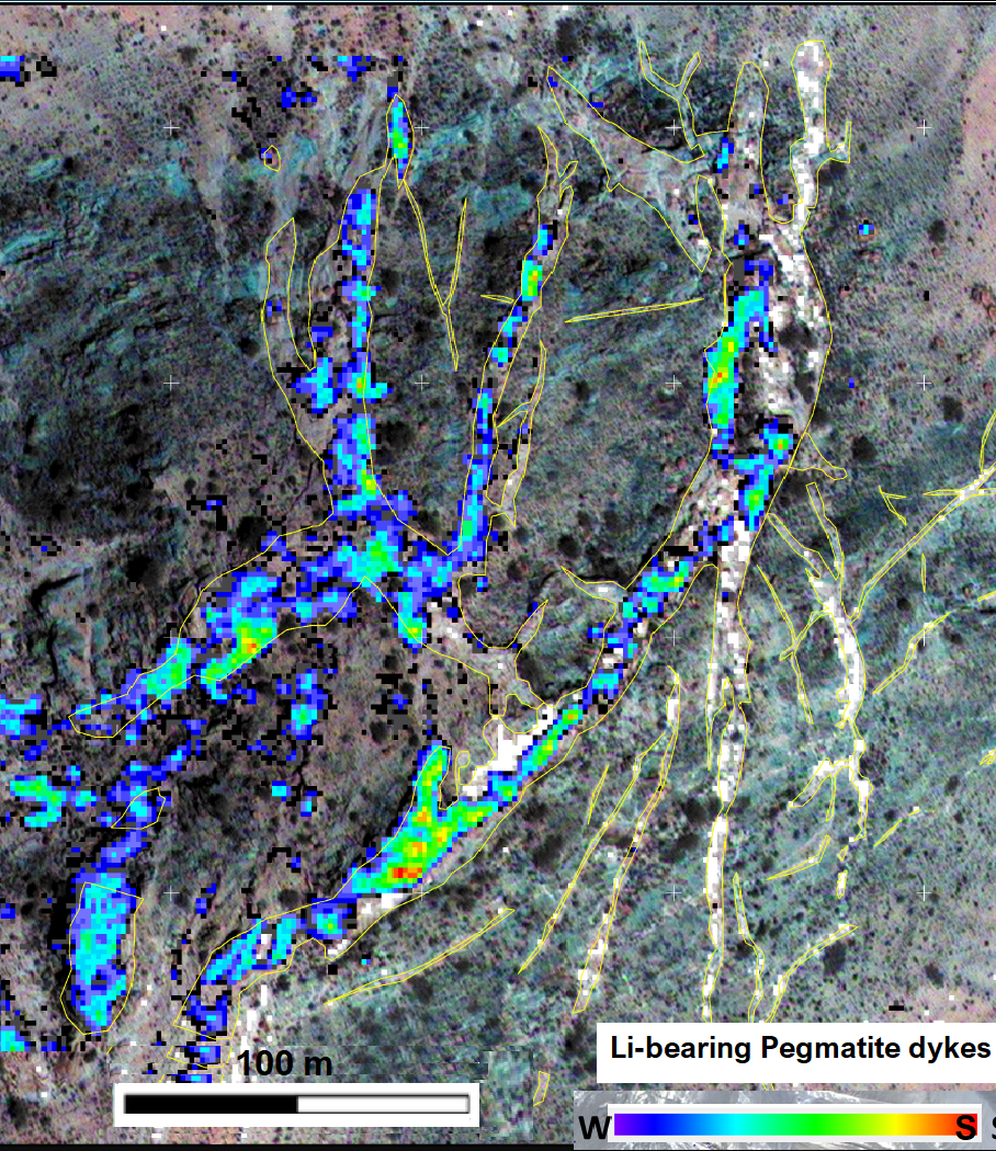
Camp-Scale Target Generation
High-resolution satellite imagery, such as commercial WorldView-3, combined with other exploration datasets and mineral systems, enables detailed mapping of specific alteration minerals (e.g. lepidolite in lithium-bearing pegmatite dykes or pyrophyllite and alunite in epithermal gold systems), iron oxides, and structural controls using VNIR–SWIR SuperCube processing (~30cm to 3.7 m resolution).
Deliverables: GIS-ready mineral maps, vector layers, favourable RGB composites, ranked targets, and reports.

Reconnect with your body and mind as you escape the noise of everyday life.