Home / Case Studies
Case Studies
Discover GeoSpectra’s case studies highlighting how satellite imagery and geospatial technologies drive efficient mineral targeting, drilling decisions, and deposit modelling from regional to prospect scale.

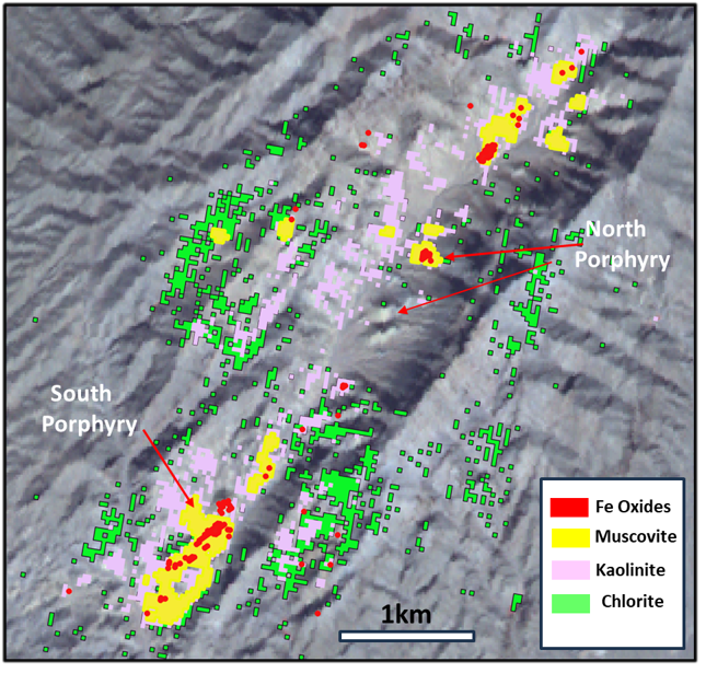
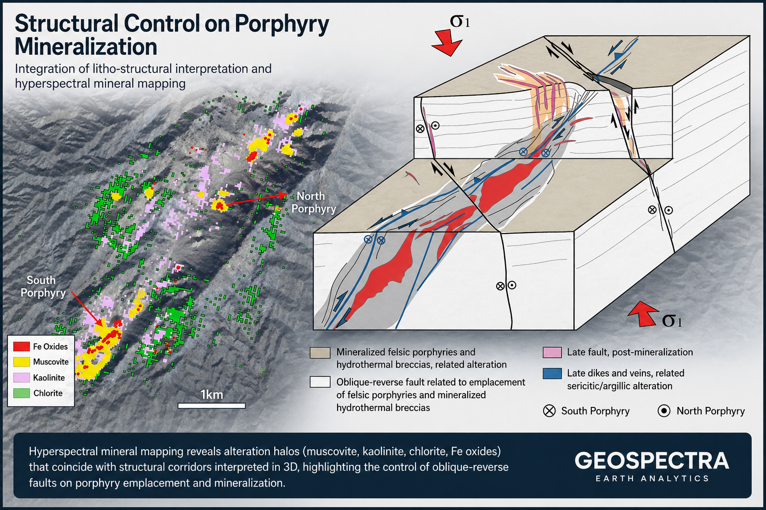
Mineral/structural mapping for targeting prospect-scale gold and copper mineralization potential by spectral analysis of multispectral Worldview-3 imagery
This case study demonstrates the effective application of commercial WorldView-3 high-resolution imagery and advanced spectral analysis to support on-ground mineral exploration. The approach enables precise mapping of hydrothermal alteration minerals and structural controls, and the delineation of high-priority targets for Iron Oxide-Copper-Gold (IOCG) and related mineral systems in an area of 200 sq km.
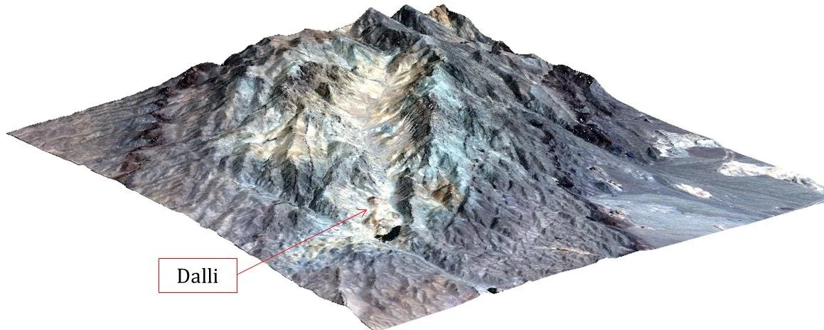
3D Visualization
By fusing elevation data with enhanced satellite data and spectrally derived mineral maps, GeoSpectra enhances the interpretation of key exploration controls, including fault systems, lithological contacts, and alteration zonation. The 3D visualization environment supports improved spatial understanding of mineralized zones, allowing exploration teams to better assess the geometry, continuity, and depth potential of targets.
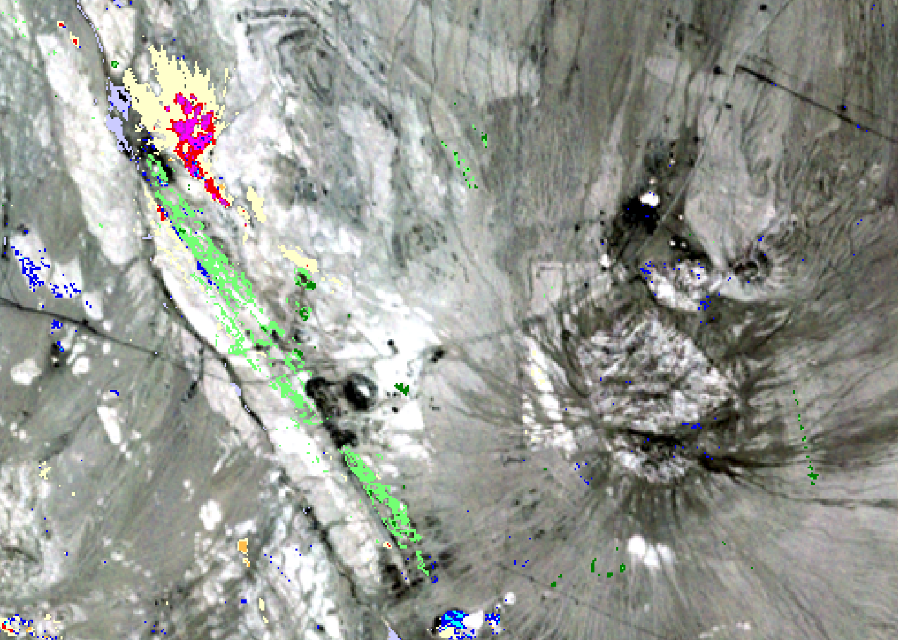

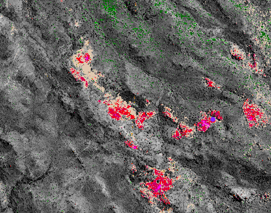
Mineral/structural mapping for targeting regional-scale gold and copper mineralization potential by spectral analysis of hyperspectral EnMAp imagery
This case study illustrates the spectral analysis of hyperspectral EnMAP imagery with 224 bands and 30 m resolution across the VNIR and SWIR, covering an area of 900 sq km, for mineral and structural mapping and targeting epithermal gold and porphyry copper-gold mineralisation at a regional scale. Several first and second-priority targets were identified for on-ground exploration.
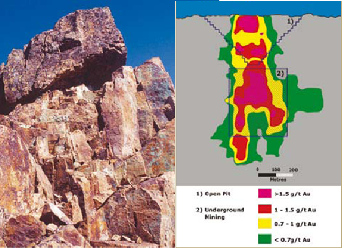

AI-Driven Drilling Targeting and Porphyry Cu-Au Deposit Modeling
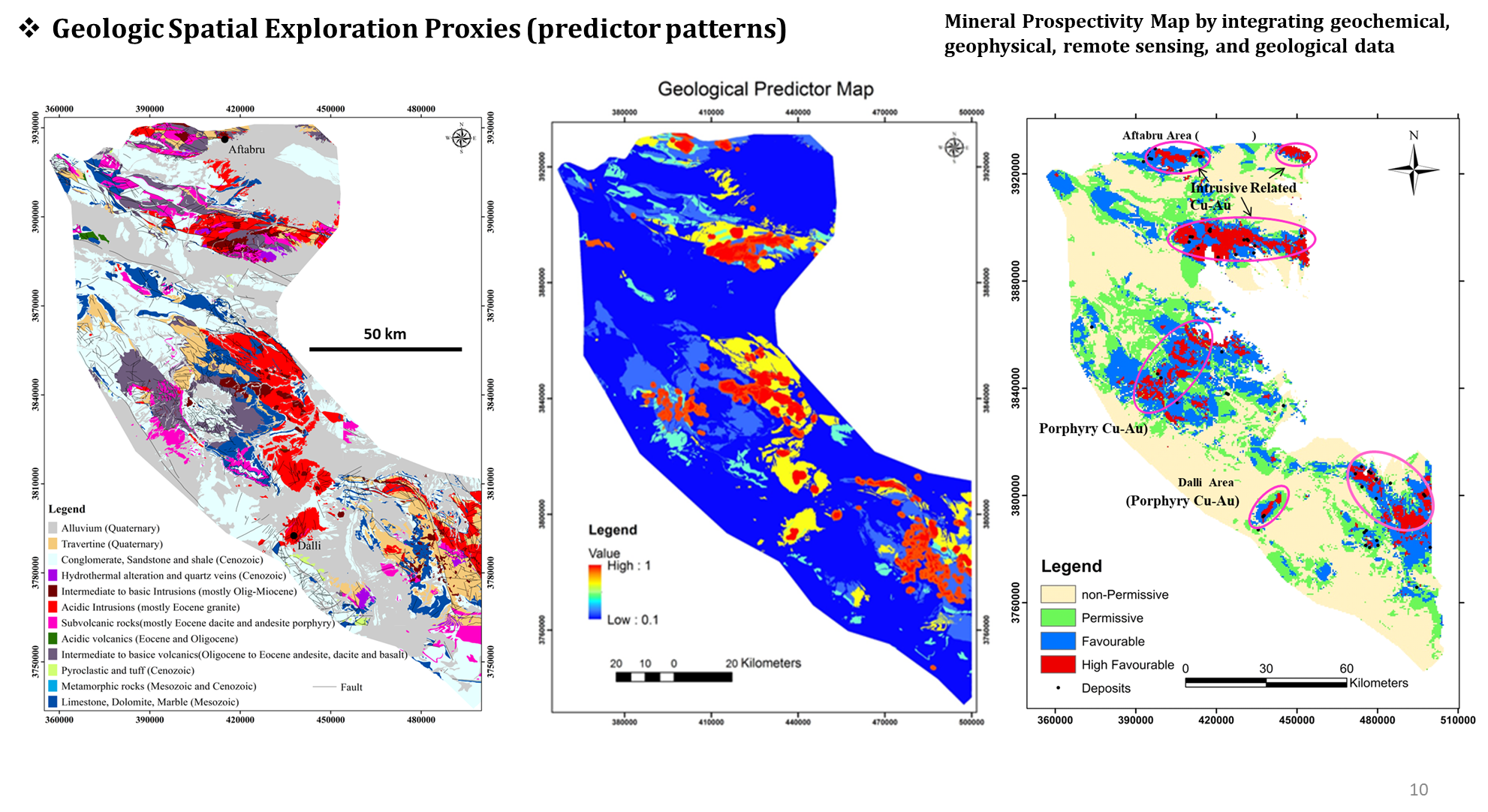
GeoSpectra applies an integrated, mineral systems–based framework, combined with advanced machine learning semi-supervised classification and data integration modelling to generate, refine, and optimise drilling targets, model a porphyry copper-gold deposit and estimate reserves across preliminary and detailed exploration
GeoSpectra applies advanced machine learning and data integration to identify and prioritise metallic mineral targets across regional to deposit scales. By combining multisource datasets—such as spectral imagery, geophysics, geochemistry, and geology—with mineral systems knowledge, our models detect complex spatial relationships and refine high-potential targets. At the deposit scale, higher-resolution datasets and drillhole information are incorporated to refine targets, optimise drill planning, and support 3D prospectivity modelling. This approach improves targeting accuracy, reduces exploration risk, and supports efficient, data-driven decision-making.