
Services
GeoSpectra provides end-to-end geospatial solutions—from satellite imagery acquisition to advanced analysis, mapping, and spatial data management—enabling smarter decisions and optimized operational performance in mineral exploration.
Multispectral Mineral Mapping
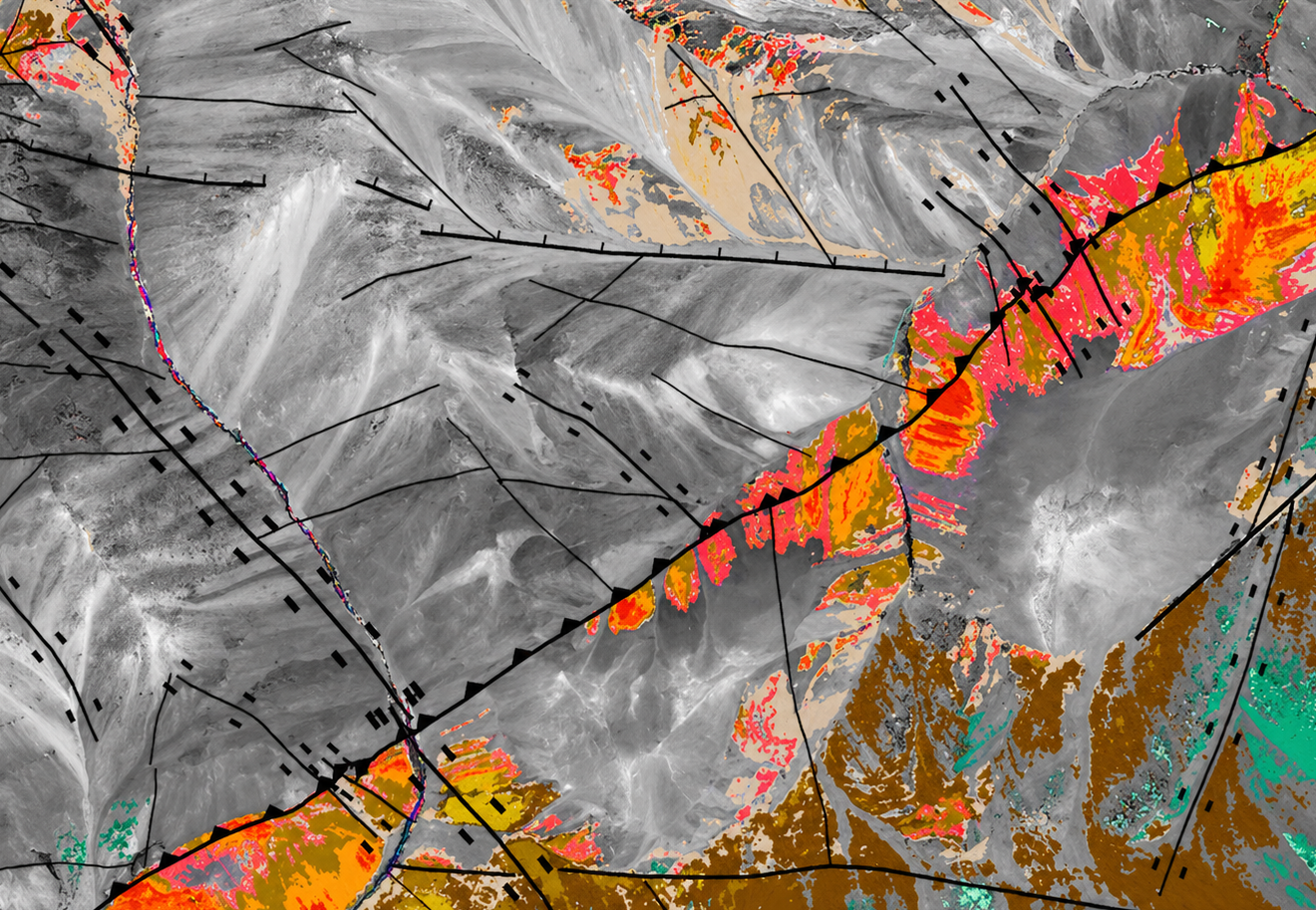
GeoSpectra delivers advanced spectral analysis of medium to high-resolution multispectral imagery (e.g., Aster and Worlview-3) to map structures and key alteration minerals of the area’s mineral systems, including favorable clays, sulphates, carbonates, iron oxides, and silica, for regional and camp-scale on-ground exploration.

Hyperspectral Mineral Mapping
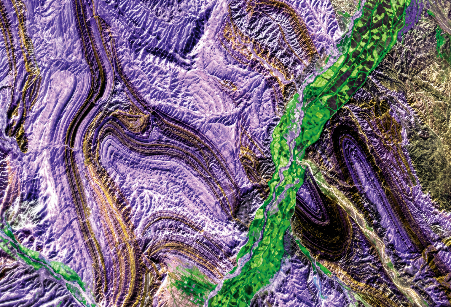
GeoSpectra delivers advanced spectral analysis of hyperspectral satellite imagery (EnMAp and PRISMA) to map structures and key alteration minerals of the area’s mineral systems, including favorable clays, sulphates, carbonates and iron oxides for on-ground regional-district scale exploration.
Structural and Lithological Mapping
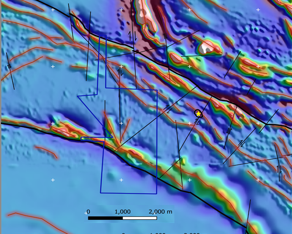
GeoSpectra process high-resolution satellite imagery to delineate structures and lithological boundaries at regional to prospect scales. By integrating structural/lithological interpretation with other exploration data, we identify key geological controls on mineralisation.
AI Data Integration- Mineral Targeting
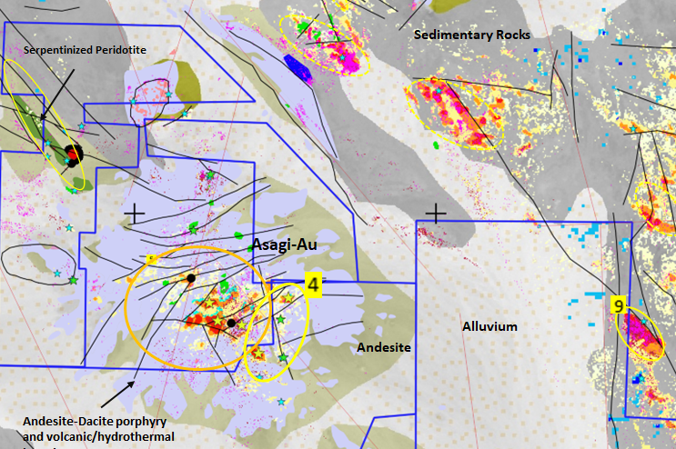
GeoSpectra applies conventional and AI-based exploration data integration to identify and prioritise mineral targets across regional to prospect scales for on-ground exploration. This approach improves targeting accuracy, reduces exploration risk, and supports efficient, data-driven decision-making.
Geospatial Modeling
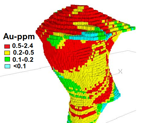
GeoSpectra uses machine learning-based semi-supervised classification and block modelling, within mineral systems frameworks, to optimize drilling targets, model deposits, and estimate reserves across the exploration lifecycle.
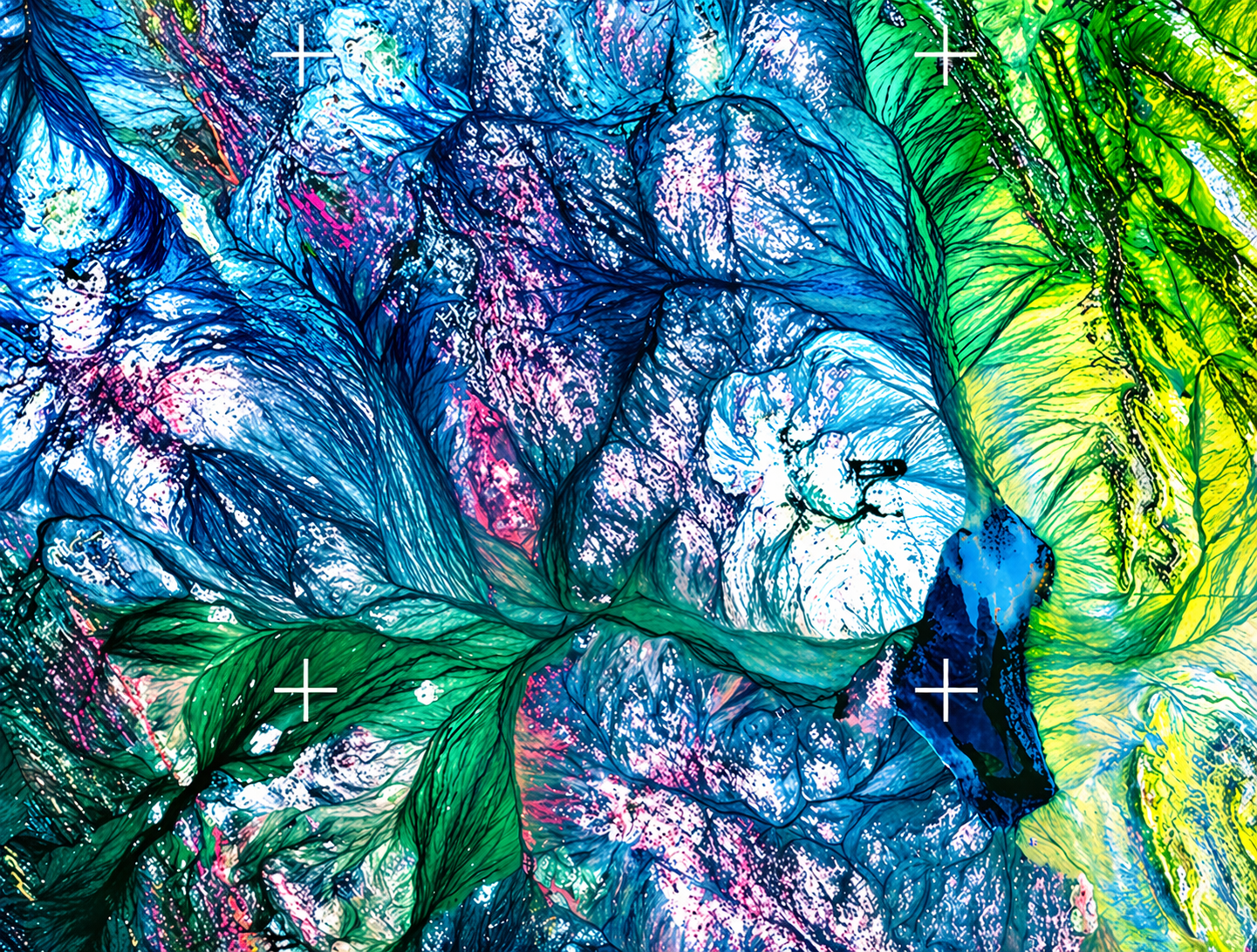
Image Processing
Some satellite imagery require geometric (orthorectification), radiometric and atmospheric corrections before spectral analyses. GeoSpectra has developed inhouse workflows to correct and apply 2D and 3D enhancement of the multi- and hyperspectral satellite imagery (videos and images) for advanced interpretation.
Exploration Data Processing & Interpretation
GeoSpectra processes and interprets multi-source geochemical and geophysical datasets, integrating them with remote sensing and geological information to support mineral potential mapping from regional to deposit scale.
Precious and Base Metals Targeting
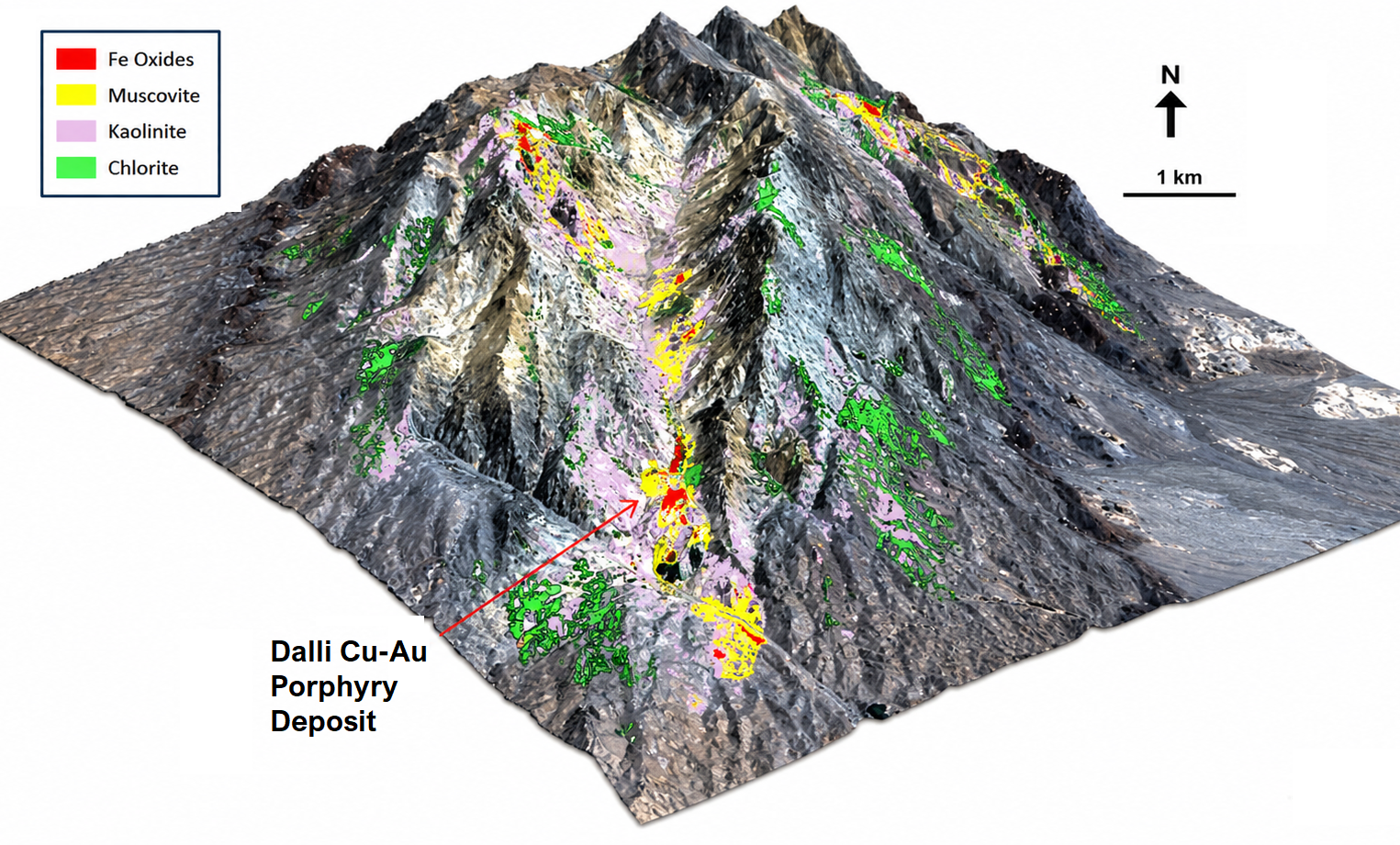
GeoSpectra applies advanced spectral remote sensing to map key alteration minerals—such as certain muscovite, chlorite, clays and iron oxides porphyry Cu-Au systems—and delineate favourable structural controls. These insights are integrated with other geospatial data to define high-priority targets for regional to prospect-scale field exploration.

Critical Mineral Targeting
GeoSpectra applies advanced spectral remote sensing to identify indicator minerals in critical mineral systems, including lithium-bearing minerals (e.g., lepidolite, spodumene) and iron oxides in pegmatites, calcite–silica–iron oxide signatures in REE-bearing carbonatites, and dolomite–clay–silica signatures in Ga–Ge-bearing MVT systems.